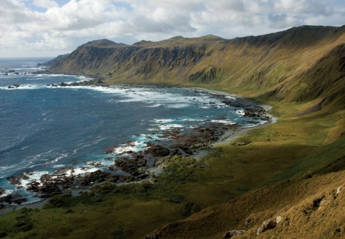
Macquarie Island lies atop a geographic feature named for the island, the Macquarie Ridge. This seafloor ridge is aligned along the eastern margin of the tectonic plate boundary between the Indo-Australian Plate and the Pacific Plate.
It was a part of Esperance Municipality until 1993, when the municipality was merged with other municipalities to Huon Valley. The island is home to the entire Royal Penguin population on earth during their annual nesting season.
Fabian Gottlieb von Bellingshausen, who explored the area for Alexander I of Russia, produced the first map of Macquarie Island. Bellingshausen landed on the island on the 28th of November 1820, defined its geographical position and traded his rum and food for Macquarie Island’s fauna with the sealers.
The years 1810 to 1919, seals and then penguins were hunted almost to the point of extinction. A rare uplifted portion of the sea bed at the edge of two tectonic plates of the earth’s crust, the island was declared a World Heritage property in 1997 for its geological qualities.
The island lies beside the southern extension of the great Alpine Fault of New Zealand and experiences frequent earth tremors. But it is also home to vast quantities of Southern Ocean birds and mammals, a factor that made it a prime target of commercial interests in the 19th and early 20th century.
When it was first discovered, Macquarie Island was also of interest to scientists. The Russian expedition led by Thaddeus von Bellinghausen collected flora and fauna on the island in 1820. Charles Wilkes’s US Exploring Expedition and two New Zealand scientists, JH Scott and A.
Hamilton, followed. Joseph Burton spent three and a half years from 1896 collecting specimens while working with oiling parties on the island. Scientists with Captain Robert Scott in 1901 and Sir Ernest Shackleton in 1909 also collected specimens on the island.
Macquarie Island has outstanding universal value for two reasons. First, it provides a unique opportunity to study, in detail, geological features and processes of oceanic crust formation and plate boundary dynamics, as it is only place on earth where rocks from the earth’s mantle (6 kilometres below the ocean floor) are being actively exposed above sea level. These unique exposures include excellent examples of pillow basalts and other extrusive rocks.

Macquarie Island
The island is the exposed crest of the undersea Macquarie Ridge, raised to its present position where the Indo-Australian tectonic plate meets the Pacific plate. These unique exposures provide an exceptionally complete section of the structure and composition of both the oceanic crust and the upper mantle, and provide evidence of ‘sea-floor spreading’ and tectonic processes that have operated for hundreds of millions of years.
The island’s natural history has been a magnet for scientists and for over 50 years Australia has operated a research station at the northern end of the island. The station is home to over 40 people over the summer and around 20 through winter. A wide variety of research is carried out on the island including biology, botany, auroral physics, meteorology and medical research.